
The growing problem of wildfires is raging out of control. On average, approximately 60,000 wildfires scorch around 8 million acres in the U.S. each year. (1)
The enormity of these numbers can be hard to grasp, but each digit represents a significant amount of destruction and loss. These fires are not isolated incidents; they are a growing problem in the United States and globally. As our climate changes, we see an increase in their frequency and intensity.
Key Takeaways
- Wildfires, which can be naturally occurring or human-induced, are a growing global issue, causing extensive damage to properties and posing threats to human lives. (2)
- The increasing frequency and intensity of wildfires are correlated with climate change. (3)
- Overdevelopment in wildland-urban interfaces, climate change, and human activities are primary risk factors contributing to wildfires. (4)
- States like California, Texas, and Colorado are particularly prone to wildfires due to geographical and climatic conditions and population growth in high-risk zones. (5)
- Future projections indicate an increase in wildfire risks in other states, including Wyoming, Arizona, New Mexico, and Utah, due to climate change and development in high-risk areas. (6)
Brief Explanation of Wildfires
Wildfires are uncontrolled fires that rapidly spread across vegetation and forest areas. They can occur naturally, ignited by heat from the sun or a lightning strike, but unfortunately, many are caused by human activity.
In 2022 alone, nearly 65,000 wildfires were recorded nationwide, burning over a whopping 7 million acres. (7) These figures serve as stark reminders of the destructive power of such fires and how they have become increasingly commonplace in our world today.
Learn More – What Happens If Your Home Burns Down In A Wildfire?
The Impact of Wildfires on Human Lives and Property
The devastation wrought by wildfires is twofold: they pose serious threats to both human lives and properties. (8) The rising number of wildfires correlates with an increased risk to life and property as climate change worsens. Homes are destroyed, communities are displaced, and tragically, lives are often lost.
The financial cost is astronomical, with billions spent each year on firefighting efforts, property damage repairs, and recovery support for affected individuals and communities. (9)
Importance of Choosing the Right Location to Live to Avoid Wildfires
Given the scale of this issue, it becomes crucial for potential homeowners to consider wildfire risks when choosing where to live. It’s not just about selecting a beautiful house in a pleasant neighborhood; it’s also about understanding the potential hazards associated with the location. This includes assessing the area’s history with wildfires and taking necessary precautions to mitigate potential risks. Taking these steps not only ensures the safety of your family but also helps secure the longevity of your investment.
In the following sections, we will delve deeper into how homeowners insurance can play a pivotal role in protecting your home from the devastating effects of wildfires.
Understanding the Risk Factors for Wildfires
In order to effectively protect your home from wildfires, it’s essential to understand the risk factors that contribute to these destructive events. These risk factors can be broadly categorized into three main areas: overdevelopment in wildland-urban interfaces, climate change, and human activities.
Learn More – What Is Legally Considered An Act Of God?
Role of Overdevelopment in Wildland-Urban Interface
Overdevelopment in areas where urban habitats meet or intermingle with undeveloped wildland areas, also known as the wildland-urban interface, significantly contributes to increased wildfire threats. (10) As housing developments expand into these areas, they encroach on natural habitats and increase the likelihood of human-caused fires.
Definition and Explanation of Wildland-Urban Interface
The wildland-urban interface is a term used to describe areas where human-made structures like homes and businesses are in close proximity to undeveloped lands or vegetative fuels. The development of these regions has placed more people and properties directly in the path of potential wildfires.
Consequences of Overdevelopment in These Areas
The surge in population growth in these high-risk fire zones has been staggering. Particularly in states such as California, Oregon, Washington, and Texas, we’ve seen population numbers soar. In high-hazard regions of the wildland-urban interface alone, there’s been a 160% growth from 1990 to 2010, bringing 2.6 million more people into these dangerous zones. (11) Even low-hazard regions have seen a significant increase of 107%, resulting in an additional 10.4 million residents.
The Role of Climate Change in Increasing Wildfire Threats
While human activity plays a significant role in sparking wildfires, climate change acts as a catalyst that intensifies their occurrence and severity.
Explanation of How Climate Change Worsens Wildfire Conditions
Climate change is stoking the danger of wildfires to new levels every year by creating warmer, drier conditions. (12) These climatic changes lead to longer and more active fire seasons, and they increase the aridity of forest fuels during the fire season. This essentially creates a perfect storm for wildfires to thrive.
The Projected Increases in Wildfire Exposure Due to Climate Change
Looking ahead, climate change is set to steeply increase U.S. properties’ exposure to wildfire risks over the next 30 years. Projections indicate that an average annual 1 degree Celsius temperature increase could boost the median burned area per year by a staggering 600% in some types of forests. (13)
Human Activities Contributing to Wildfires
The role of human activity in igniting wildfires cannot be overstated. In fact, approximately 90% of all wildfires are directly attributable to human causes. (14)
Common Human-Induced Causes of Wildfires
From negligent actions like improperly extinguished campfires and discarded cigarettes, human activities continue to be a leading cause of wildfires.
Importance of Preventive Measures to Protect Lives, Property, and Natural Resources
Fortunately, there are steps homeowners can take to mitigate these risks. Creating a defensible space of at least 100 feet around your home and retrofitting your home with fire-retarding materials or double-paned windows can significantly improve your home’s chances of surviving a wildland fire.
Keep in mind that preparing your home for wildfire threats shouldn’t be a last-minute rush as fire season approaches. Instead, take advantage of the cooler and wetter winter months to create your defensible space, retrofit your home if necessary, and ensure you’re ready well before wildfire season begins.
Learn More – What Are High Risk Items In Home Insurance?
High-Risk Areas for Wildfires in the United States
When discussing wildfires, it’s important to note that certain areas in the US are more prone to these destructive events than others. Factors such as climate, vegetation, and human activities create high-risk zones where wildfires are likely to occur.
States with High Risk for Wildfires – California, Texas, Colorado
Certain states bear the brunt of this fiery menace more than others. Among them, California, Texas, and Colorado stand out due to their unique geographical and climatic conditions.
Specific Reasons for High Wildfire Risk in These States
California tops the list with the most properties at risk of wildfire damage. (16) This is due to a combination of factors, including dry weather conditions, abundant vegetation that serves as fuel for fires, and a large number of homes built in or near highly flammable wildland areas.
Texas and Colorado, too, face high wildfire risks owing to similar reasons. In addition to climatic conditions conducive to wildfires, these states also have rapidly growing populations in wildfire-prone areas.
Insurance Challenges Faced by Homeowners in These States
For homeowners in these high-risk areas, securing comprehensive homeowners insurance can prove challenging. Traditional insurance may not be readily available or could come with steep premiums reflecting the heightened risk.
However, there are alternatives. Fire insurance policies specifically designed for fire-related damages and FAIR Plans (Fair Access to Insurance Requirements), which are state-mandated insurance pools designed to provide coverage where traditional insurance falls short, offer viable options for homeowners in high-risk areas.
Future Projections of Wildfire Risks in Other States
As we look toward the future, projections indicate an increase in wildfire risks across other states as well.
Predicted Increases in Properties at Major Risk – Wyoming, Arizona, New Mexico, Utah
States such as Wyoming, Arizona, New Mexico, and Utah are predicted to see the biggest increases in properties with major wildfire risk by 2052. (15)This is largely due to changes in climate and continued development in high-risk areas.
Potential Risks in Unexpected Areas – Florida, Texas
Interestingly, even states like Florida and Texas, which are not traditionally associated with high wildfire risk, may experience increased wildfire threats in unexpected areas. This underscores the changing nature of wildfire risk and the importance of staying informed about evolving trends in your area.
As we navigate through these challenges, remember that knowledge is power. Understanding your wildfire risks can help you make informed decisions about where to live, how to protect your home, and what insurance coverage is right for you.
Tools and Resources for Assessing Wildfire Risks
To best navigate the wildfire risk landscape, it’s essential to make use of available tools and resources designed to help assess these risks. Today, we’ll focus on two such resources: the interactive map by the California Public Utilities Commission (CPUC) and the “Fire Factor” risk score by First Street Foundation.
Interactive Map by the California Public Utilities Commission (CPUC)
The CPUC has developed an interactive map that highlights areas at high risk for wildfires. (17) This resource proves invaluable in providing a visual representation of risk levels across different regions.
Explanation of Map Categories – Elevated Threat (Orange) and Extreme Threat (Red)
The map is color-coded with two categories of threat levels: elevated threat (marked in orange) and extreme threat (marked in red). As you might expect, areas marked in red indicate high wildfire risk, while those in orange represent a slightly lower but still considerable threat.
How the CPUC Uses This Information to Enforce Fire Safety Regulations
This information allows the CPUC to enforce higher fire safety regulations effectively in high-risk areas. These safety measures include frequent inspections of power lines, clearing vegetation around these lines, and prioritizing fixing fire hazards. By focusing their efforts where they’re most needed, CPUC can mitigate potential damages from wildfires.
“Fire Factor” Risk Score by First Street Foundation
Another instrumental tool for assessing wildfire risks is the “Fire Factor” risk score released by First Street Foundation, a nonprofit organization dedicated to addressing environmental challenges.
Explanation of How the “Fire Factor” Risk Score Works
The “Fire Factor” risk score is an open-source model that simulates fire behavior to provide a probabilistic view of wildfire movement. (18) This innovative approach helps capture changing wildfire risk profiles, making this tool incredibly valuable given our rapidly changing climate.
How This Information Can Be Used by Individuals and Businesses
The practical applications of the “Fire Factor” risk score are numerous. It will soon be integrated into real estate listing sites and commercial property services, providing potential homeowners and businesses with a clearer understanding of the wildfire risks associated with a particular property. In fact, First Street Foundation has released data calculating wildfire risk for every property in the contiguous United States, making it easier than ever to assess wildfire risks.
These tools and resources are essential in our fight against wildfires. Understanding your specific risks can guide you in taking necessary precautions and securing appropriate insurance coverage to protect your home.
Safe Places to Live to Avoid Wildfires
When it comes to choosing a place to call home, the threat of wildfires can be a significant factor. However, certain areas of the country have considerably lower risks. In this section, we will look at some regions and specific places known for their low wildfire risk.
The Midwest as a Safe Region
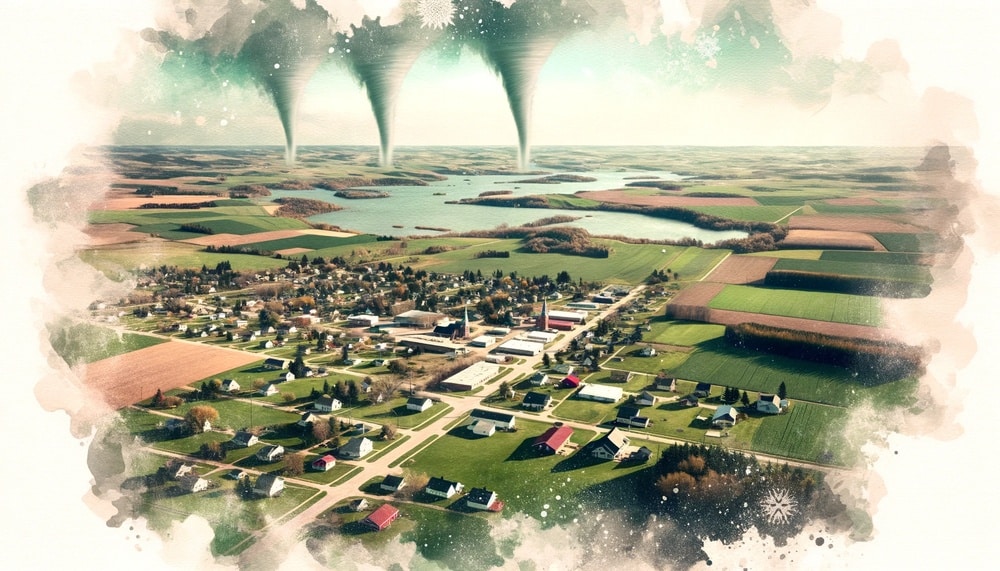
The Midwest region of the United States is often associated with tornados and “lake effect” snowstorms. While these weather phenomena pose their own challenges, one advantage of living in the Midwest is the significantly lower risk of wildfires, hurricanes, and coastal flooding.
Explanation of Why the Midwest Has a Lower Risk of Wildfires
With its climate and geographical features, the Midwest doesn’t provide the ideal conditions that wildfires typically thrive in. Unlike drier states, where vegetation dries up quickly, providing fuel for fires, the Midwest usually has more rainfall and less flammable vegetation.
Specific Places in the Midwest with Low Natural Disaster Risk
Among specific places in the Midwest with low wildfire risk are Lima, Ohio; Weston, Wisconsin; Duluth, Minnesota; Appleton, Wisconsin; and Eau Claire, Wisconsin. (19)Each has its unique features contributing to its safety from wildfires.
For instance, Lima, Ohio, experiences hailstorms but has a low chance of wildfires, flooding, or drought. Weston, Wisconsin, ranks high for community resilience against disasters but faces winter-related hazards. Duluth, Minnesota, has nearby forests and parks, increasing its wildfire risk slightly but is largely safe from earthquakes.
Appleton, Wisconsin, sees little to no risk of flooding and drought but does face cold waves. Eau Claire, Wisconsin, also boasts a low risk of earthquakes and hurricanes but has a slightly higher risk of flooding due to surrounding lakes and rivers.
Preventive Measures for Property Owners in High-Risk Areas
Even if you reside in an area with higher wildfire risks, there are measures you can take to protect your property. Maintaining a defensible space around your home and retrofitting your home with fire-retarding materials or double-paned windows can greatly reduce the risk of your home catching fire. (20)
Closing Thoughts on the Importance of Understanding and Mitigating Wildfire Risks When Choosing Where to Live
Regardless of where you live, understanding the wildfire risks associated with your area is crucial. Even more so, taking steps to mitigate these risks can make all the difference in protecting your property and ensuring your safety. With careful selection and proper preventive measures, you can find a safe place to call home without living in constant fear of wildfires.
References
- National Interagency Fire Center. (2022). National Year-to-Date Report on Fires and Acres Burned. Retrieved from National Interagency Fire Center
- National Park Service. (2022). Wildfires: Causes and Effects. Retrieved from National Park Service
- IPCC. (2021). Climate Change 2021: The Physical Science Basis. Retrieved from IPCC
- Radeloff, V. C., Helmers, D. P., Kramer, H. A., Mockrin, M. H., Alexandre, P. M., Bar-Massada, A., … & Stewart, S. I. (2018). Rapid growth of the US wildland-urban interface raises wildfire risk. Proceedings of the National Academy of Sciences, 115(13), 3314-3319.
- California Department of Forestry and Fire Protection. (2022). Top 20 Most Destructive California Wildfires. Retrieved from CAL FIRE
- Schoennagel, T., Balch, J. K., Brenkert-Smith, H., Dennison, P. E., Harvey, B. J., Krawchuk, M. A., … & Moritz, M. A. (2017). Adapt to more wildfire in western North American forests as climate changes. Proceedings of the National Academy of Sciences, 114(18), 4582-4590.
- National Interagency Fire Center. (2022). National Year-to-Date Report on Fires and Acres Burned. Retrieved from National Interagency Fire Center
- FEMA. (2022). The True Cost of Wildfire in the U.S. Retrieved from FEMA
- National Interagency Fire Center. (2022). Federal Firefighting Costs (Suppression Only). Retrieved from National Interagency Fire Center
- Radeloff, V. C., Helmers, D. P., Kramer, H. A., Mockrin, M. H., Alexandre, P. M., Bar-Massada, A., … & Stewart, S. I. (2018). Rapid growth of the US wildland-urban interface raises wildfire risk. Proceedings of the National Academy of Sciences, 115(13), 3314-3319.
- Theobald, D. M., & Romme, W. H. (2007). Expansion of the US wildland–urban interface. Landscape and Urban Planning, 83(4), 340-354.
- IPCC. (2021). Climate Change 2021: The Physical Science Basis. Retrieved from IPCC
- Abatzoglou, J. T., & Williams, A. P. (2016). Impact of anthropogenic climate change on wildfire across western US forests. Proceedings of the National Academy of Sciences, 113(42), 11770-11775.
- National Park Service. (2022). Wildfires: Causes and Effects. Retrieved from National Park Service
- Schoennagel, T., Balch, J. K., Brenkert-Smith, H., Dennison, P. E., Harvey, B. J., Krawchuk, M. A., … & Moritz, M. A. (2017). Adapt to more wildfire in western North American forests as climate changes. Proceedings of the National Academy of Sciences, 114(18), 4582-4590.
- California Department of Forestry and Fire Protection. (2022). Top 20 Most Destructive California Wildfires. Retrieved from CAL FIRE
- California Public Utilities Commission. (2022). Fire-Threat Map. Retrieved from CPUC
- Finney, M. A., Cohen, J. D., McAllister, S. S., & Jolly, W. M. (2013). On the need for a theory of wildland fire spread. International Journal of Wildland Fire, 22(1), 25-36.
- National Interagency Fire Center. (2022). Wildfire Risk to Communities. Retrieved from NIFC
- CAL FIRE. (2022). Ready for Wildfire: Defensible Space. Retrieved from Ready for Wildfire


